Weather
Meteorological Warns of Summer Storms as Heatwave Continues
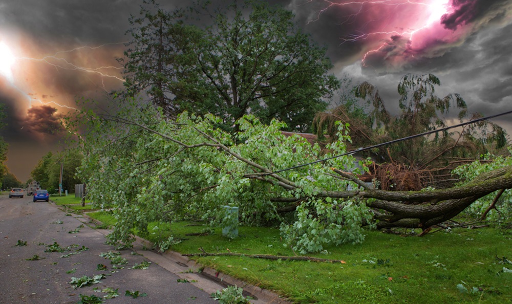
Thailand’s Meteorological Department Summer has reported that storms are forecast to provide relief from weeks of scorching heat from Friday to Tuesday, but residents should be prepared for high winds and hail.
Winds from the West, Southeast, and South are forecast to reach exceptionally hot regions in the Central Plains, as well as the country’s northern and northeastern regions, according to the report released Thursday.
From Friday to Sunday, upper portions of the North and Northeast should expect a boost in westerly winds. Then, on Monday and Tuesday, winds from the south and southeast will hit the northeast, east, central plains, and lower north.
As a result, residents can expect summer storms, including hailstorms, in the North, Northeast, and Central Plains on Friday and Saturday, as well as in the North, Northeast, Central Plains, and East from Sunday to Tuesday.
The Meteorological Department predicted that the wet season will begin in earnest around the fourth week of this month.
Nationwide Heatwave
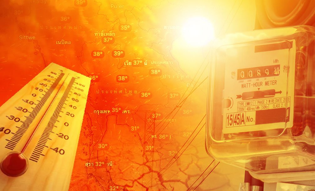
Thailand is experiencing an extreme heatwave. The Southeast Asian country is experiencing record-breaking heat, with temperatures rising beyond 40°C (104°F) in numerous areas. Authorities have issued health warnings, advising residents and tourists to stay hydrated and avoid excessive sun exposure.
The searing heat has taxed electrical infrastructure, resulting in intermittent blackouts as air conditioners operate at full capacity. Schools have modified their schedules or closed temporarily, while outside workers struggle to cope with the relentless light. Hospitals have reported an increase in heat-related ailments, notably among the elderly and young children.
Agricultural sectors are not immune either. Thailand’s important rice and fruit exports could suffer losses owing to crop damage and reduced yields. Farmers are looking for solutions to protect their crops, including shade nets and greater irrigation. If the heatwave continues, it might have a severe economic impact.
While heatwaves are not uncommon in Thailand’s tropical environment, experts attribute this year’s severity to climate change. They warn that extreme weather events will become more common and severe, creating significant challenges to the country’s infrastructure, public health, and critical sectors.


Weather
Hurricane Beryl Rapidly Intensifies, Becoming First Major Hurricane of 2024 Atlantic Season
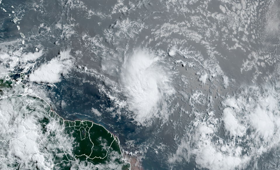
(CTN News) – Hurricane Beryl is rapidly intensifying in the Atlantic Ocean, becoming the first named hurricane of the 2024 season.
Beryl is currently a Category 1 hurricane with maximum sustained winds of 75 mph, but forecasters warn it could strengthen into a dangerous major hurricane (Category 3 or higher with winds over 111 mph) before reaching the southeastern Caribbean by late Sunday or early Monday.
A hurricane warning has been issued for Barbados, while hurricane watches are in effect for St. Lucia, Grenada, and St. Vincent and the Grenadines. Tropical storm watches have been posted for Martinique, Dominica, and Tobago.
Meteorologists are stunned by Beryl’s rapid organization and intensification this early in the hurricane season, noting that the storm is developing over exceptionally warm late June waters in the deep tropics.
This is highly unusual, as only 5 major hurricanes have formed in the Atlantic before the first week of July historically.
Impacts and Preparations as Hurricane Beryl Approaches the Caribbean
Beryl is expected to bring heavy rainfall, dangerous storm surge, and hurricane-force winds to the affected islands. Barbados could see up to 6 inches of rain, while a storm surge of up to 7 feet is forecast.
Preparations are underway, with shelters opening and essential services being readied.
The 2024 Atlantic hurricane season is predicted to be extremely active, with forecasts of 17-25 named storms, 8-13 hurricanes, and 4-7 major hurricanes. Beryl’s early development is an ominous sign of what may be to come in the months ahead.
Weather
Punjab, Pakistan Expected to Experience Heatwave with Temperatures Up to 50°C Until Monday

(CTN News) – According to the Punjab Disaster Management Authority, there will be a heatwave in Punjab until Monday, when temperatures may rise as high as 45 to 48 degrees Celsius during the day.
According to the PDMA spokesman, severe heatwave conditions are possible in the Bahawalpur, Rahim Yar Khan, DG Khan and Multan districts of Southern Punjab.
Record High Temperatures in Sindh Amid Heatwave
All concerned departments have been instructed to remain alert to any untoward situation. According to the spokesman, citizens are being made aware of the dangers of the heatwave through the media.

A heatwave that has been affecting major cities throughout Sindh has continued. On Friday, the maximum temperature soared to a record 51 degrees Celsius.
According to the Met Office, Mohenjo Daro was the hottest place in the country last week, with a maximum temperature of 51°C, followed by Jacobabad and Khairpur (both 50°C).
In Larkana and Dadu, the maximum temperature reached 49°C, while in Rohri and Sukkur, it reached 48.5°C, while in Padidan, it reached 48°C, in Shaheed Benazirabad, it reached 46.5°C, in Mithi, it reached 46.5°C, in Sakrand, it reached 46°C, while it reached 44.5°C in Tando Jam and Hyderabad, it reached 44.5°C.
Karachi’s weather was hot, too. The maximum temperature reached 36.7°C, and the humidity count was 55 percent, indicating a lot of moisture in the air.

According to the Met Department’s daily advisory, “very hot” weather is expected to be experienced in most parts of Sindh, including Karachi, during the next 24 hours.
A similar warning was issued for the province’s coastal areas, stating that “humid conditions” would also prevail there.
As a result, the daytime temperatures in upper districts of Sindh are expected to remain six to eight degrees centigrade above average during this period, according to the report.
If people need assistance in an emergency, they can contact the PDMA’s Helpline number 1129 or Rescue number 1122.
Weather
April Weather Update: Chilly Showers Persist But Warmer Days Ahead For UK

(CTN News) – As April nears its end, the UK remains entrenched in a pattern of damp and chilly weather, despite glimmers of warmer temperatures on the horizon.
Over the weekend, parts of the southeast experienced a deluge, with rainfall reaching 25mm to 30mm within 24 hours—exceeding half of the April average for some locales.
UK Weather Update
While Sunday saw temperatures ranging from a modest 9°C to 13°C (48°F to 55°F) across the UK, a shift is anticipated as the new week unfolds. Meteorologists project that by Monday and Tuesday, temperatures could climb to a more pleasant 16°C or 17°C (61°F or 63°F).
This warming trend is expected to persist throughout the week, with forecasts hinting at temperatures reaching the high teens by Friday and Saturday.
According to predictions from the Met Office, Cardiff and Belfast may see temperatures reaching 16°C from Thursday onwards. In Edinburgh, a more modest 14°C (57°F) is anticipated, while London and Manchester could bask in balmy temperatures of 18°C (64°F).
https://twitter.com/metoffice/status/1784304054887174256?ref_src=twsrc%5Etfw%7Ctwcamp%5Etweetembed%7Ctwterm%5E1784304054887174256%7Ctwgr%5E9712c8412f97588b734d6b30fdae96f8952a0c5f%7Ctwcon%5Es1_&ref_url=https%3A%2F%2Fnews.sky.com%2Fstory%2Fuk-weather-fed-up-with-cold-april-temperatures-are-about-to-rise-13124796
Despite these projections, the prevailing sentiment remains one of April showers and chilly breezes. Amy Bokota, a senior meteorologist, notes that while the month has seen fluctuations, it has actually been “on the warmer side of average.”
Bokota remarks, “It’s been a month of two halves—quite warm for the first half, and then quite cool up until now.”
However, this apparent chilliness may be exacerbated by the persistently damp conditions. Bokota observes that April has been “wetter than average for the UK as a whole,” resulting in a drearier atmosphere than expected for this time of year.
April Rainfall Surpasses Average, But Temperature Extremes Persist
Across the UK, rainfall for April has averaged at 99mm so far—a notable 27% higher than the usual figures for the month.
Despite these gloomy statistics, there have been moments of temperature extremes scattered throughout the month. From a high of 21.8°C in Writtle, Essex, to a bone-chilling low of -6.3°C in Shap, Cumbria, April has showcased its penchant for meteorological variety.
Even as spring progresses, surprises abound, with Braemar in Aberdeenshire experiencing an unusually cold -5.2°C on Saturday night.
When asked why perceptions of cold may outweigh the statistical reality, Bokota suggests that recent weeks have been cooler than average, contributing to an overall sense of dreariness.
“It’s been quite a dull month—duller than it should be on average—so there’s been less sunshine around,” she explains. “It’s been mainly unsettled and changeable, so I think that just sort of feeds into people’s interpretation of what the weather feels like.”
As April draws to a close, the UK remains poised between showers and sunshine, with hopes pinned on the promise of warmer days ahead.
SEE ALSO:
Record-Breaking Sale: Titanic’s Wealthiest Passenger’s Gold Pocket Watch Fetches £1.2 Million
Thailand Issues “Hot Weather Warning” As Temperatures Climb Past 45 Degrees Celsius
Elon Musk Rejects ‘Alien’ Connection to Missing Flight MH370
-

 News4 years ago
Let’s Know About Ultra High Net Worth Individual
-
Entertainment2 years ago
Mabelle Prior: The Voice of Hope, Resilience, and Diversity Inspiring Generations
-

 Health4 years ago
How Much Ivermectin Should You Take?
-

 Tech2 years ago
Top Forex Brokers of 2023: Reviews and Analysis for Successful Trading
-

 Lifestyles3 years ago
Aries Soulmate Signs
-

 Movies3 years ago
What Should I Do If Disney Plus Keeps Logging Me Out of TV?
-

 Health3 years ago
Can I Buy Ivermectin Without A Prescription in the USA?
-

 Learning3 years ago
Virtual Numbers: What Are They For?